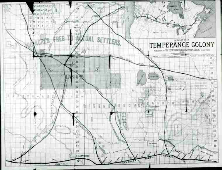
Map of the Temperance Colony
 | ||
| Database ID | 28414 | |
| Institution | Saskatoon Public Library Local History Room | |
| Fonds/Collection | General Photographs Collection | |
| File/Item Reference | LH-5050-N | |
| Date of creation | 1883 | |
| Physical description/extent | one photograph; b&w; 9.5 cm x 7 cm | |
| Number of images | 1 | |
| Scope and content | A photograph of a map of the Temperance Colony as printed in publicity brochure in 1883, with inset maps of Canada and proposed City of Saskatoon. Indian reservations, railway lines, trails and physical features drawn in. (Black and white version of coloured original is misleading) | |
| Restrictions on access | There are no restrictions on access. | |
| Copyright holder | public domain | |
| Other terms governing use and reproduction | Credit Saskatoon Public Library, Local History Room. | |
| Type | Archival | |
| Primary Media | Artwork | |
| Provenance Access Point | General Photographs Collection | |
| Language of material | English | |
| Treaty boundaries | Treaty 6 | |
| Cultural region | Plains | |
| Names | Temperance Colonization Society | |
| Subject | Reserves -- Limits Maps | |
| Date Range(s) | 1880-1889 | |
| Permanent Link | https://digital.scaa.sk.ca/ourlegacy/permalink/28414 |
|