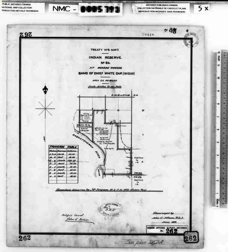
Reproduction of map of Moose Woods Indian Reserve
 | ||
| Database ID | 28197 | |
| Institution | Saskatoon Public Library Local History Room | |
| Fonds/Collection | General Photographs Collection | |
| File/Item Reference | LH-5399 | |
| Date of creation | 1888 | |
| Physical description/extent | one image; b&w; 16 cm x 18 cm | |
| Number of images | 1 | |
| Scope and content | Local History Room files LH-5397 to 5399 are reproductions of maps of Moose Woods. LH 5399 is a resurvey conducted in 1888 of the original 1881 survey. The old reserve boundaries can be compared to the new ones on this map. | |
| Restrictions on access | There are no restrictions on access. | |
| Copyright holder | public domain | |
| Other terms governing use and reproduction | See Public Archives of Canada for permission to use. | |
| Type | Archival | |
| Primary Media | Photographs | |
| Provenance Access Point | General Photographs Collection | |
| Location of originals | Public Archives of Canada, National Map Collection. NMC-5793 | |
| Treaty boundaries | Treaty 6 | |
| Cultural region | Plains | |
| Names | Wapahaska Whitecap | |
| Subject | Reserves -- Limits | |
| Date Range(s) | 1890-1899 | |
| Permanent Link | https://digital.scaa.sk.ca/ourlegacy/permalink/28197 |
|